
In my upcoming release, A Touch of Honor (Book 7 in the Realm Series), John Swenton travels to Penrith to meet with John Loudon McAdam (see December 19, 2013 post). I have discovered many interesting details of the area, and I thought to share them with you.

Penrith Castle 1772
Penrith is a market town and in the county of Cumbria, England. Penrith lies less than 3 miles (5 km) outside the boundaries of the Lake District National Park. Historically a part of Cumberland, the local authority is Eden District Council, which is based in the town. Penrith was formerly the seat of both Penrith Urban and Rural District Councils. Penrith has no town council of its own, and is an unparished area.
It is in the Eden Valley, just north of the River Eamont. Other local rivers bounding the town are the River Lowther and the River Petteril. A partially man-made watercourse, known as Thacka Beck, flowing through the centre of the town, connects the Rivers Petteril and Eamont. For many centuries, the Beck provided the town with its main water supply. Thacka Beck nature reserve provides flood storage which protects homes and businesses in Penrith.
History
Toponymy
It is generally accepted that the name Penrith is of Cumbric origin, though the exact etymology of the name has been debated.
Several toponymists favour a derivation from the local equivalents to the Welsh or Cumbric pen ‘head, chief’ (both noun and adjective) + Cumbric ‘rid’, Welsh rhyd ‘ford’. On this basis, the name would therefore mean ‘chief ford,’ ‘hill ford’ or Whaley’s suggestion: ‘the head of the ford’ or ‘headland by the ford.’
Objections to this theory have been raised on the grounds that the present town of Penrith lies around 1 mile from the nearest crossing point on the River Eamont at Eamont Bridge. An alternative has been suggested consisting of the same pen element meaning ‘hill’ + the equivalent of Welsh rhudd ‘red.’ The name ‘red hill’ may refer to the large Beacon Hill to the north east of the current town. There is also a place called ‘Redhills’ to the south west near the M6 motorway.
Archaeology
Excavation of a section of the Roman road from Manchester to Carlisle in advance of an extension to Penrith Cemetery showed that the road survived better at the edges of the field. The cobble and gravel surfaces appeared to have been entirely ploughed out at the centre. The road was constructed by excavating a wide, shallow trench below the level of subsoil. Large cobbles were probably obtained from nearby, as they did not appear frequently within the subsoil in the excavated area. The cobbles were added to the excavated subsoil, and this was dumped back into the cut to form a stable foundation, which was raised in the centre of the road to form a camber.
Divisions and Suburbs
Castletown
Castletown is the area to the west of the railway line and includes the Gilwilly Industrial Estate and part of the Penrith or Myers Industrial Estate. The area – which was originally built to house workers on the railway line – mostly consists of late 19th and early 20th century housing (mainly terraced) including some council housing but in recent years modern housing developments such as Greystoke Park, Castletown Drive and Castle Park have sprung up.
There was until March 2010 a pub in the suburb, The Castle Inn and in previous years there was a sub-postoffice, Co-op store and other shops all now closed. Until the 1970s Castletown had its own church, St Saviour’s in Brougham Street which acted as a chapel of ease to Penrith’s parish church of St Andrew.
The suburb has a community centre on the recreation ground at Gilwilly and did until recently hold an annual gala day and parade throughout Penrith. At one time in the mid 20th century elections were held amongst regulars at the Castle pub to find a Mayor of Castletown. There is a long standing rivalry between the Castletown and Townhead districts.
Townhead
Townhead is the general name for the northern area of the town, which also includes the Fair Hill district and the Voreda Park or Anchor housing estate.
The main part of area is built along both sides of the A6 road heading up the hill in the direction of Carlisle. The road is streetnamed as Stricklandgate and Scotland Road but on maps dating before the mid 19th century was just marked as Town Head.
Town Head was one of the 7 townships or constablewicks that the ancient parish of Penrith was divided into the others were Middlegate, Burrowgate, Dockray and Netherend within the town proper and Plumpton Head and Carleton outside the town.
New Streets
The New Streets is a name for the area between Townhead and Scaws on the side of the Beacon Hill (or Fell) which consists of steep streets of some terraced housing but mainly large detached and semi detached houses mostly laid out in the late 19th century going up the hill. The streets are – from north to south – Graham Street, Wordsworth Street, Lowther Street, and Arthur Street. The term is sometimes extended to include Fell Lane (which is actually the ancient east road from Penrith town centre leading to Langwathby), and Croft Avenue and Croft Terrace (dating from c.1930). However, the late date of the development of the latter streets place them outwith the traditional definition of the term. At the foot of the streets is Drovers Lane which is sub-divided along its entire length into Wordsworth Terrace, Lowther Terrace, Bath Terrace, Arthur Terrace, Lonsdale Terrace and finally Meeting House Lane. Running along the top of the streets is Beacon Edge from which spectacular views can be seen over the town and towards the Lake District. Until about the turn of the 20th century, Beacon Edge was known as Beacon Road. As well as the streets going up the fellside there are some that connect the streets such as Beacon Street and smaller housing developments in the gaps between the individual streets. The fellside is known to have been used as a burial ground for victims of the many attacks of plague which struck Penrith down the centuries, and there are also areas which still bear the names of the farming which took place in the area. For example, a now wooded enclosed area on Fell Lane is still known as ‘the Pinfold’ (or Pinny) and was used to house stray animals until their owner paid a fine to release them. Also, a lane off Beacon Edge is still known as ‘Intack Lane’ (that is, the lane to farmed land). Most of the land that formed the “intack” itself was used to form Penrith Cemetery.
Scaws
The Scaws Estate was first built by Penrith Urban District Council almost immediately after World War II on land previously known as The Flatt Field and Scaws Farm which formed part of the Lowther Estates. Scaws Farm is now known as Coldsprings Farm. The name was changed following a murder which took place at the farm.
In later years some private housing was built on the higher parts of the estate.
Beaconside Infants and Junior Schools are located in the centre of the estate and there were at one time 3 corner shops and a launderette in the area.
Adjoining Scaws are the privately owned Barcohill and Meadow Croft housing estates.
Carleton
Carleton, once a separate settlement, is the area of Penrith that has seen the most growth of housing in the past 30 years.
Carleton Village itself is a small line of houses along one side of the A686 road that forms part of the boundary of the town’s built up area; at the junction of the A686 and Carleton Road (formerly the A66 road) is the Cross Keys Inn.
On the other side of the road and to the east of Carleton Road is the large High Carleton housing estate which was started in the 1960s and is still growing. The estate is subdivided into the Frenchfield Way/Gardens area, the original High Carleton area, Carleton Park or Parklands, Carleton Meadows and Carleton Heights most of the streets in this area are named after trees or other plants e.g.: Oak Road, Sycamore Drive, Juniper Way. A small stream runs through the estate. Oak Road connects Carleton with Meadow Croft and Scaws. To the west of High Carleton is Winters Park where Penrith Rugby Union Football Club has its ground and the Carleton Hall Gardens estate.
Carleton Hall is the headquarters of the Cumbria Constabulary.
At Frenchfield just south of Carleton Village towards Brougham Castle is the Hunter Hall Preparatory School and new Eden District Council-owned sports pitches.
Pategill
Adjoining Carleton is the Pategill Housing Estate which started as a council estate on land that once formed part of the Carleton Hall estate in the 1960s and is still mostly owned by housing associations. Two streets on the estate namely Prince Charles Close and Jubilee Close were opened by HRH The Prince of Wales in 1977.
The centre of the estate is accessible by foot only and there was until 2012 a small convenience store here.
Several properties are run as sheltered accommodation for the elderly.
Wetheriggs
The Wetheriggs, Skirsgill and Castle Hill or Tyne Close areas were first developed in the 1920s by the Penrith UDC on land formerly known as Scumscaw and the first private housing to be developed was Holme Riggs Avenue and Skirsgill Gardens just prior to World War II.
Further development did not start until the 1960s and 1970s when land between Wetheriggs Lane and Ullswater Road was built on though it was not until the late 1980s that the two roads were connected after the building of the Clifford Road extension which saw the Skirsgill area developed.
Within the area are three schools: Ullswater Community College. North Lakes Junior and Queen Elizabeth Grammar School (QEGS). The Crescent on Clifford Road is a block of elderly sheltered accommodation. There was formerly a shop at the junction of Huntley Avenue and Clifford Road next to North Lakes School.
The large North Lakes Hotel and Spa stands at the junction of Clifford and Ullswater Roads overlooking the Skirsgill Junction 40 Interchange of the M6 motorway, A66 and A592 roads.
Landmarks

The Giant’s Grave in 8135
The main church is St. Andrew’s, built from 1720 to 1722 in an imposing Grecian style, abutting an earlier 13th-century tower. The churchyard has some ancient crosses and hogback tombstones in it known now as “Giant’s Grave,” and “Giant’s Thumb” which is the remains of a Norse cross dated to 920 AD.
The ruins of Penrith Castle (14th-16th centuries) can be seen from the adjacent railway station. The castle is run as a visitor attraction by English Heritage. To the south-east of the town are the more substantial ruins of Brougham Castle, also under the protection of English Heritage.

The ruins of Penrith Castle in 2008
To the south of the town are the ancient henge sites known as Mayburgh Henge and King Arthur’s Round Table. Both are under the protection of English Heritage.
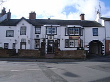
In the centre of the town is the Clock Tower, erected in 1861 to commemorate Philip Musgrave of Edenhall. Hutton Hall, on Folly Lane, preserves a 14th-century pele tower at the rear, attached to an 18th-century building. The Gloucester Arms public house, formerly known as Dockray Hall, is said to date from c1470 and may incorporate the remains of another pele tower.
Dockray Hall
Penrith has been noted for the number of wells in and around the town, and well-dressing ceremonies were commonplace on certain days in the month of May. Three miles south-east of the town, on the River Eamont are the “Giants’ caves,” where the well was dedicated to St. Ninian. The caves are enlarged out of Lower Permian sandstones and their associated breccias and purple shales.
Just to the north of the town is the wooded signal-beacon hill, naturally named Beacon Hill, but originally called Penrith Fell. It last use was probably in 1804 in the war against Napoleon. Traditionally, the Beacon Pike was used to warn of approaching danger from Scotland. Today, although surrounded by a commercial woodland owned by Lowther Estates, the hill still contains some natural woodlands and is a popular local and tourist attraction. On a clear day the majority of the Eden Valley, the local fells, Pennines and parts of the North Lakes can be seen. It is almost certain that the Beacon Hill gave Penrith its name – in Celtic – of “red hill.”
A fibreglass 550 cm (18 ft)-tall statue of King Kongonce stood in the market, it is now at the market place on the outskirts of Penrith.
Notable People
Penrith was the home town of William Wordsworth’s mother, and the poet spent some of his childhood in the town, attending the local school with Mary Hutchinson his later wife.
George Leo Haydock (1774–1849), noted for his annotated edition of the Catholic Douay Bible, served as pastor of the Catholic Church here from 1839 until his death in 1849.
The MP and social reformer Samuel Plimsoll spent part of his childhood living at Page Hall in Foster Street. The row of houses at Townhead called Plimsoll Close is named after him.
Mary, the wife of Prime Minister Harold Wilson, lived in Penrith for part of her life whilst her father was minister at the Congregational Church in Duke Street.
The Victorian writer Frances Trollope, (Anthony Trollope’s mother) lived for a while at a house called Carleton Hill (not be confused with Carleton Hall) just outside the town on the Alston road.
The Scottish road-builder and engineer John Loudon Macadam the inventor of “Macadamized” roads (not Tarmacadam as that came later) lived for a while at Cockell House in Townhead. Close by Cockell House today are the streets Macadam Way and Macadam Gardens.
The feature film Withnail and I features the real Penrith very briefly, but most of the filming locations were actually in and around nearby Shap. The “Penrith Tea Rooms” scene was filmed in Stony Stratford (Milton Keynes).
Charlie Hunnam, British actor, attended Queen Elizabeth Grammar School, Penrith (QEGS) and lived locally in the area during his teenage years. He is known for his roles as Nathan Maloney in the Channel 4 drama Queer as Folk, Lloyd Haythe in the Fox comedy series Undeclared, Pete Dunham in the film Green Street, Jackson “Jax” Teller in the FX series Sons of Anarchy, and Raleigh Becket in the film Pacific Rim. 
Oliver Turvey, Racing Driver, attended Queen Elizabeth Grammar School, Penrith(QEGS) and lives locally.
Angela Lonsdale was born in Penrith. She is perhaps best known for playing policewoman Emma Taylor in Coronation Street and is currently starring as DI Eva Moore in the BBC soap, Doctors.
Paul Nixon, Leicestershire wicket keeper and current England cricket international was born in Carlisle but grew up in the Penrith area.
Penrith is the birthplace of the footballer Stephen Hindmarch.
Will Addison, professional rugby union player currently representing Sale Sharks rugby union club attended Queen Elizabeth Grammar School, Penrith, making his début in the Aviva Premiership on 8 April 2011 against Gloucester Rugby union club at only 18 years of age.
Lewis Brett Guy (born 22 August 1985 in Penrith, Cumbria) is an English footballer who plays as a forward. He is currently playing for Milton Keynes Dons.
John Taylor (1 November 1808 – 25 July 1887), third President of the Church of Jesus Christ of Latter-day Saints, lived in Penrith as a young man, until he emigrated to Canada in the early 1830s.


