
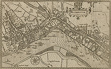
This 1593 map shows “The Strande” as the principal route – parallel to the River, from the City in the east, to Whitehall in the west.
This 1593 map shows “The Strande” as the principal route – parallel to the River, from the City in the east, to Whitehall in the west.
